Where are the students going, where are they coming from, in Minnesota’s Open Enrollment? MREA released a map today to help answer those questions.
Minnesota has had open enrollment for over two decades. The map aims to identify any patterns to the student movement. To display trends, the map shows student movement in and out of any district as a percentage of the resident students in that district. A thumbnail is provided below. Click here to view the interactive map.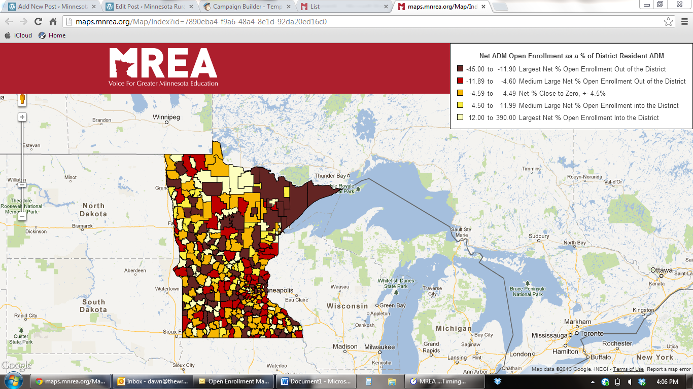
Open enrollment is both physical movement to neighboring districts and charter schools and virtual movement to on-line providers which can be districts or charter schools. The map itself makes no attempt to explain why students and families choose to move physically or virtually.
- Physical trends among districts can be spotted where widely varying colors abut one another
- Trends to charters or virtual providers can be spotted where there are net open enrollment out districts with no adjacent districts with widely varying colors
- Open enrollment occurs both the metro and rural regions of the state
- Click here for a table of districts, net % open enrollment and net ADM open enrollment to districts and charter schools
- Click here for a more detailed table of where students go to or come from for each MN district